The Port of Providence has a long and proud history of being a working waterfront that has shaped our region’s economy. Indeed, several Providence Working Waterfront Alliance members have continuously operated in the port for more than 100 years.
Below, please find historic photographs and a brief history of Providence Harbor and the Port of Providence excerpted from “Urban Waterfronts in the 21st Century: Shaping Policy for the Port of Providence,” a master’s thesis by Austin Becker of the University of Rhode Island’s Coastal Resources Center.
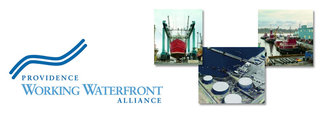
- Historic photos: Providence Harbor Then & Now
- Historic Photos: Sprague Energy
History of Providence Harbor
Founded in 1636 at the convergence of two rivers and Narragansett Bay, Providence early on developed as an active center for fishing and trading. In the late 18th century, the British occupation of Newport during the Revolutionary War forced commercial activity out, and merchants brought their trades north to Providence. Although Newport offered a better harbor, being 20 miles closer to the open sea with a larger amount of protected deep water, Providence was protected not just from the elements, but also from the British by Colonial forts located on hills on either side of the Providence River.
Through the 18th and early 19th centuries, ships anchored off of India Point and berthed along South Water Street, bringing in cargos of slaves and goods such as rum and molasses. The China trade turned Providence into a major international port. India Point, at the southern edge of the city, earned its name from trade with the West Indies and from the tea and spice cargo from East Asia that were imported and offloaded there by wealthy merchants such as John Brown. Schooners sailed up the river as far as Westminster Street, docking at piers and in the old Ship Street Canal. They transferred cargo into the brick warehouses that still line South Water Street and offloaded coal at Point Street.
With the advent of the Industrial Revolution, vessels got larger and deeper, and bridges began to cross the Providence River. Most maritime activity moved south to India Point and closer to Narragansett Bay, and Providence evolved into a modern industrial cityport. In the 19th century, wharves and warehouses lined the shoreline along the Old Harbor District, up the Seekonk River in East Providence, and along Allens Avenue. Ships sailed in loaded with raw materials and left with cargos of manufactured goods made in factories in Pawtucket, Providence, and East Providence. In 1853, The U.S. Army Corps of Engineers (USACE) completed the first of many dredging projects in the Providence River. Ships sailed for ports around the world, and passenger steamers departed for cities all over New England, while immigrants arrived from the Azores, Ireland, and Italy, often finding work as longshoremen or sailors.
The railroad brough rapid changes to the watefront. Although a rail line was established down to India Point, the passengers and freight centralized at the downtown station, and India Point and the Seekonk River docks entered a period of decline. Coal continued to be handled out of facilities just south of the Hurricane Barrier (at what is now known as “Collier Park”) and barges still moved up the Seekonk River supplying a number of petroleum facilities, as well as Ocean State Steel in East Providence. In the 1970s, a public park replaced the scrap metal facility at India Point. Today, that scrap business continues at Fields Point, keeping the dirt and grit associated with shredding and loading scrap far from Providence’s downtown area.
The Hurricane Barrier, built in 1956 just south of Point Street in Providence, cut Providence’s inner harbor off from most commercial activity due to the overhead clearance of the barrier and the silting-in of the river. Today, the Providence River north of the barrier features a riverwalk and public space, as well as a marina and a few waterfront restaurants. The only maritime industry north of the barrier is Dominion Electric, which relies on river water to cool its power plant. North of the Point Street Bridge, the river itself is quite shallow and only canoes, kayaks, and the smallest powerboats can navigate the area. Similarly, the Seekonk River, once a corridor for ships sailing all the way to Pawtucket, no longer sees commercial traffic aside from the occasional tour boat. The Washington Bridge, once a bascule (moveable) bridge, was closed permanently in 1968 to make way for Interstate 195. Despite a history of schooners and steamers docked along their edges, the Providence River north of the barrier and the Seekonk River north of the Washington Bridge will not likely see ship traffic again.
Port of Providence Today
The market served today by the Port of Providence covers 2,000 square miles, includes Rhode Island, Northeastern Connecticut, and Southeastern Massachusetts and provides for goods and services for a population of over a million people. Approximately 20 water-dependent facilities utilize the port and provide services to the region. Ships from around the world utilize the deep-water federal channel, bringing products in from Central and South America, Europe, East Asia, Russia, Africa, Australia and New Zealand. While petroleum imports comprise the majority of product that moves through the port, asphalt, cement, and road salt are also imported here and used for construction, road repair and maintenance for the entire state and region. The majority of the region’s energy passes through Providence Harbor via four petroleum facilities: Sprague Energy and Motiva in Providence, and Exxon Mobil and Capital Terminals in East Providence. Various other bulk products pass through the port, utilizing the intermodal opportunities presented by the interface of two major highways (Interstates 95 and 195), the deepwater port, and a railway capable of supporting double stack service. Between 2000 and 2004, the federal government reaffirmed its commitment to Rhode Island’s maritime industries by carrying out a $63 million dredging project in the Providence River. Dredging brought the channel back to a controlling depth of 40′, allowing vessels up the channel that were once forced to lighten their cargo into barges before transiting the river. In 2004, according to the National Ocean Economics Program, the ocean economy of Providence County employed 6,300 persons at 430 establishments and paid $120 million in wages. These employees contributed $220 million to the Gross State Product in Rhode Island. Note that Ocean Economy date include only ocean related activites and industries compiled from the Bureau of Labor Statistics.
